|
Vision Apps User Guide
|


|
|
Vision Apps User Guide
|
|
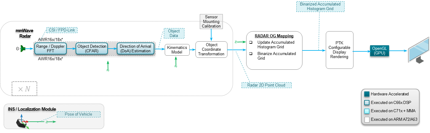
This application generates a static occupancy grid map indicating free space versus occupied space around the vehicle, using TI mmwave radars. The generated OGMAP is then used as input to a parking/free space detection algorithm block to generate a final map with different regions (free space, parkable free space) marked. Localization of the vehicle in the maps is provided by an Inertial Navigation System (INS) combining GPS (Global Positioning System) and IMU (Inertial Measurement Unit).
The resulting maps can either be visualized in real-time or saved to file.
The application makes use of the below application libraries,
| Platform | Linux x86_64 | Linux+RTOS mode | QNX+RTOS mode | SoC |
|---|---|---|---|---|
| Support | N0 | YES | NO | J721e |
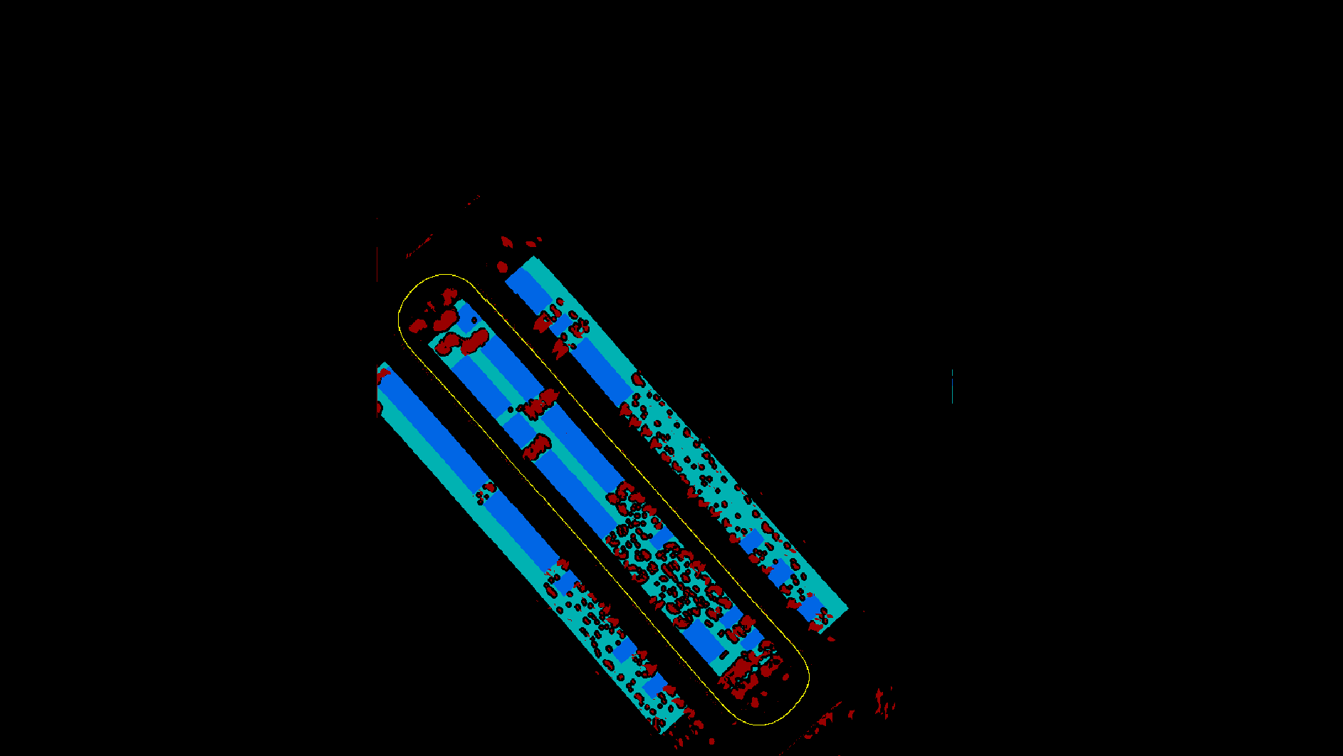
Shown below is an example output visualization showing the Radar OGMAP.
 1.8.15